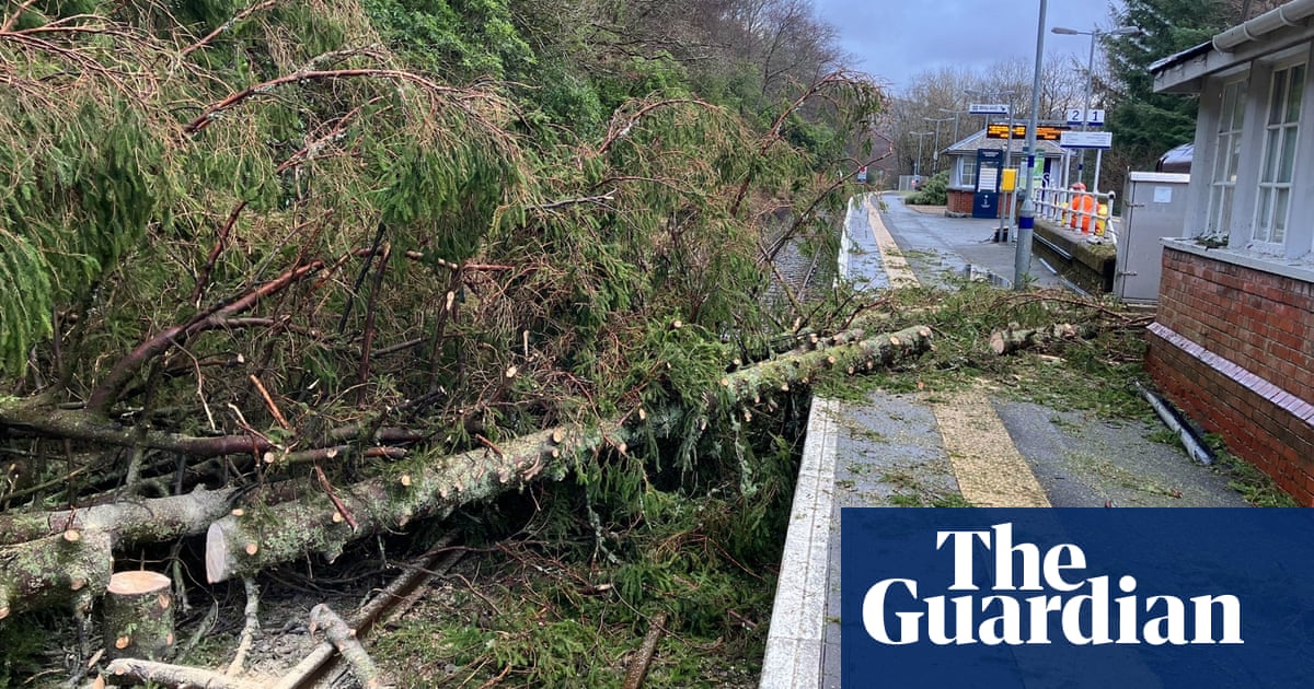
Hurricane Laura, the most powerful hurricane to strike the US this year, moved across Louisiana on a northerly path on Thursday, after threatening an “unsurvivable storm surge” on the coast and tropical force weather as far as Tennessee.
The storm slammed into western Louisiana overnight with gusts of up to 150mph and could cause “catastrophic conditions”, the National Hurricane Center (NHC) said. Not until 11 hours after landfall did it finally weaken into a tropical storm.
Concern was growing for people in the path of the storm in Louisiana who did not evacuate on Wednesday. Louisiana recorded six fatalities as of Thursday afternoon, including a 14-year-old girl in Vernon parish who died after a tree fell on her home, a 24-year-old man who died of carbon monoxide poisoning inside his home and a man who drowned while aboard a sinking ship.
Laura blasted through the Louisiana coast and made landfall as a Category 4 hurricane early Thursday, wreaking damage on the industrial, casino city of Lake Charles. The storm has left more than 875,000 people without power.
The northern eyewall of the storm moved over Cameron parish, on the Louisiana coast, at 1am ET, before slamming into the city of Lake Charles.
Authorities had ordered coastal residents to get out, but not everyone did in an area devastated by Hurricane Rita in 2005. By Thursday morning, many buildings had partially collapsed or were missing chunks. Windows were blown out, awnings ripped away and trees split in half. At the local airport, planes were overturned, some on top of each other.
More than 875,000 people were left without power in the wake of the storm. Donald Trump said he would visit the Gulf Coast this weekend to tour the damage.
Laura headed north towards Shreveport, Louisiana, on Thursday rather than west across Texas as had been one of the leading predictions, meaning the city of Houston has probably dodged a bullet, although coastal Port Arthur is threatened by storm surge flooding.
Late on Thursday morning Edwards confirmed a chemical plant outside of Lake Charles had caught fire and advised residents in the area to shelter in place.
The blaze was confirmed at a BioLab plant in Westlake, a chlorine manufacturing facility, footage showed vast plumes of emissions billowing from plant.
Although authorities had urged residents in Louisiana municipalities dotted along the coastline to evacuate there were concerns that up to 150 people in Cameron parish – where the storm landed on the US mainland – had stayed in place, leading to fears of loss of life.
“We know anyone that stayed that close to the coast, we’ve got to pray for them, because looking at the storm surge, there would be little chance of survival,” Louisiana’s lieutenant governor, Billy Nungesser, told ABC’s Good Morning America.
Laura is the region’s most powerful hurricane in over a century, and ties for the fastest storm in Louisiana history. Experts warned earlier in the year that the hurricane season would be unusually active.
Meanwhile, evidence suggests that the Atlantic hurricane season is becoming worse due to warming waters linked to the climate crisis.
The fierce wind battered a tall building in Lake Charles, blowing out windows as glass as debris flew to the ground early Thursday, more than 30 miles from the ocean. Hours after landfall, the wind and rain were still blowing hard.
The highway into Lake Charles was littered with downed power lines and mobile home parks had been flattened by the high winds.
“There are some people still in town and people are calling … but there ain’t no way to get to them,” Tony Guillory, president of the Calcasieu parish police jury, said early on Thursday morning over the phone as he was battened down in a Lake Charles government building that was shaking from the storm.
Hurricane force winds are expected to continue through the morning, according to the NHC, although Laura had weakened to a category 2 hurricane by 7am ET.
The centre warned that an “unsurvivable storm surge with large and destructive waves will cause catastrophic damage from Sea Rim state park, Texas, to Intracoastal City, Louisiana”.
The National Hurricane Center said Laura will move across south-western Louisiana this morning, and continue northward across the state through this afternoon.
The center of the storm is forecast to move over Arkansas tonight, the mid-Mississippi Valley on Friday, and the mid-Atlantic states on Saturday.
Forecasters said the storm surge could be 6 metres (20ft) deep and unsurvivable.
Authorities had implored coastal residents of Texas and Louisiana to evacuate, but many did not, before howling winds began buffeting trees back and forth in an area that was devastated by Hurricane Rita in 2005.
Social media footage showed torrents of rain rushing sideways past lampposts in Lake Charles, and streets covered with water closer to the coast.
The storm system arrived during high tide, drawing energy from the warm Gulf of Mexico.
Officials said at least 150 people rejected pleas to leave and planned to weather the storm in everything from elevated homes to recreational vehicles in coastal Cameron parish.
“It’s a very sad situation,” said Ashley Buller, the assistant director of emergency preparedness. “We did everything we could to encourage them to leave.”
The Texas governor, Greg Abbott, and his Louisiana counterpart, feared the dire predictions were not resonating with the public, despite authorities putting more than 500,000 coastal residents under mandatory evacuation orders.
Hurricane warnings were issued from San Luis Pass in Texas to Intracoastal City in Louisiana, and reached inland for 200 miles. Storm surge warnings extended from Freeport in Texas to the mouth of the Mississippi River.
Donald Trump tweeted that coastal residents should heed advice from officials.


