Come spring, chances are there’ll be driving tours in fake panda cars along the A646 between Halifax and Todmorden, with overnight stays in dodgy-looking farmhouses. Happy Valley has done for Calderdale what Peaky Blinders did for Birmingham, and dark telly tourism is all about ticking off locations and looking the part (though I’m not sure hi-vis tabards will catch on). But there are three better, more active ways to explore the Calder valley. Two of these use the Calderdale Way, either the northern section or the southern, both of which involve hill climbs and traverses across fields, hedgerows, stiles – the usual argy-bargy of agricultural rambling.
The third, easier option is the towpath of the Rochdale canal – and that is what I did, or at least how I began, getting off the train at Sowerby Bridge and heading west. Canals are flat and sometimes circuitous, but they require no navigation skills. You can look around as you amble. As they were built for industry, they take walkers close to the action – people, places, buildings – and there’s plenty to see along this valley.
If gentrification has come to some corners of West Yorkshire, it doesn’t seem to have done much to Sowerby Bridge, which is essentially a suburb of Halifax. I could see the town’s looming Wainhouse Tower – a folly built by prosperous dyer John Edward Wainhouse – as I crossed the River Calder. I followed my nose to find the canal and it took me along a street filled with ruinous light industrial units and dead pubs – a genuine urban backside. Eventually I stumbled on some steps and climbed up to the towpath.
What a joy our old canals are. I was immediately in a traffic-free zone. Joggers and e-cyclists and a few dog walkers were my only companions. Signage assured me “Pedestrians have priority.” Passing through a rift in the hillside, the canal sides seem to be hewn out of millstone grit. But soon I was walking through a wooded section, with views of sheep fields.
I wasn’t expecting much birdlife. Winter, built-up areas surrounded by intensive farmland, a windy day: not the best conditions for ornithological wonders. There were lots of Canada geese and mallards, though, and the odd shoveler. Flitting around the holly bushes and leafless canopy I saw long-tailed and blue tits, robins and blackbirds, and heard the tinkerbelling of dunnocks. The best spot of the day: a mating pair of red-crested pochards, very rare up here.
Northern canals, roads and railways typically follow the same contours. I was never bothered by the hum of traffic, though, and I felt I was getting to know the Calder in its various iterations. Where the river was wide and babbling it reminded me of the Dales. Sometimes it narrowed to a sludgy ditch, only to widen suddenly and gush forward in leaps.
Signs remind you of the distance to Manchester: the Rochdale canal was built to connect Cottonopolis with the North Sea. You can also count your progress by locks or bridges, which are numbered. All except No 14, the curved Falling Royd tunnel, were passable on foot. Occasionally the valley was wide enough to make room for a football pitch, a Methodist chapel, some nature-friendly scrubland. At Mytholmroyd is Ted Hughes’ birthplace and information boards, and a sculpture of a hawk roosting, after his famous poem.
In summer, the Calder valley can be beautiful. But it’s never quaint, and in winter it has an austere, even sombre quality. The sides are steep and high enough to delay sunrise and hasten dusk. Squat cottages in grey gritstone – often pollution-blackened – don’t look cosy so much as cramped and functional. Sometimes a westerly wind arrowed down the cut, cooled by canal water and chilling my bones. When the towpath became dead straight I was reminded of A-road trudges in my teens. There were pretty canalside terraces near Luddenden Foot, and cheery residential narrowboats at Mayroyd moorings just outside Hebden Bridge. At last, some colours other than grey, brown and green.
It’s perfectly possible to meander along the canal to whatever station you wish to use to go home. But that would mean seeing only one aspect of the valley. So, after a piece of toast and a flask-lid of tea in Hebden Bridge (where flat whites and soya chai lattes are available) I started to ascend.
There are many ways to get up on to moortop. You can use lanes, footpaths or a combination. I decided just to go for it, crossing the first bridge that took me over the railway line and finding a stone stair, zigzagging briefly along Shelf Road and Palace House Road, before a right turn on to a track, and then a precipitous trudge up through woodland. This was my first outing since before Christmas and I was soon out of puff. If in doubt, use OS map OL21 and stick to the dotted lines.
At the top was a gap in a stone wall to the right of a mobile mast. I crossed a roughly cobbled road and then a tiny gate across fields. Heading south now, a sign told me this was a public footpath to Pinnacle Lane. A couple of kissing gates later I was flung out on to bare fields. Now a serious west wind blew up, shipping in drizzle and, on the rugged rocky edges, a dense mist. If the canal, main roads and post-industrial ruins of the valley bottom belong to Sally Wainwright, this stage was more Alfred. Getting my breath back, I turned to look back on to Hebden Bridge below (an impressively compact, almost crammed-in town) and Heptonstall church, rising above the churchyard where Sylvia Plath and the fictional Becky Cawood are buried.
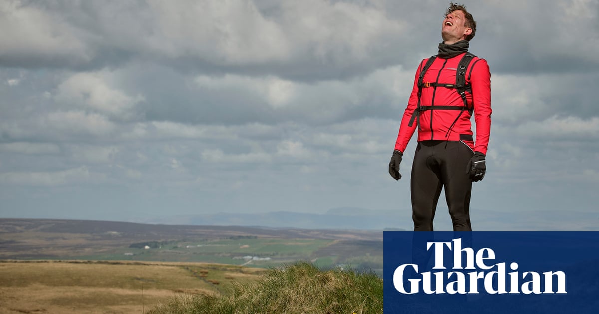
I had taken my scarf and hat off during the climb. Now they went back on, with gloves and, a little later, waterproof over-trousers. The weather turned quite Pennine/horrible/bracing (choose your adjective) as I crossed a series of fields, with small sheep cowering behind drystone walls and a hawk flying, head down, into the rain, as if Ted had sent another poem up to accompany me.
Stoodley Pike (rhyming with “rudely” not “goodly”), my “summit” for this walk, is supposed to be a peace monument – but it commemorates the allies’ vanquishing of Napoleon. It’s massive and imposing, prominent on its lonely bluff, and gives a weary hiker a solid, fixed target to aim for – even though occasionally the drifting mist buried it completely. The farm lane merged with the Pennine Bridleway and, briefly, Pennine Way, as I walked the final furlongs. I joined other walkers hiding from the weather at the base of the monument to eat my sandwich. After a quiet and solitary day, the hubbub of arrivals was unwelcome so I didn’t linger. I took the steep track down to Mankinholes and followed a series of roads and wide tracks to Todmorden. Happily, my last mile was on the canal towpath, which moored me, eventually, in a Lidl supermarket car park.
I’d walked a little over 11 miles in around four-and-a-half hours on a totally non-technical if occasionally effortful walk. As much as I enjoy watching Happy Valley, I wasn’t minded so much of its murderous moors as of Elmet, the last Celtic region to fall to the Angles – “Badlands where outcast and outlaw/Fortified the hill–knowle’s long outlook”, as Hughes put it. Why the ancient intimation? Perhaps because everything else has gone, almost. The coal mines and wool trade, which turned the upper Calder into “the hardest-worked river in England”, are no more. The extant chimneys are smoke-free. The old inns are gastropubs or detached homes. The farmers no longer come down to market. Rooted communities have been displaced by incoming ones.
Hughes wrote eloquently about nature reclaiming industrial sites, and hinted at his homeland’s radical regionalism. Perhaps the Celts would rise again, or the northerners at least, against the de-naturing south. Funnily enough he also ruminated on television and its potential to displace dreams. Happy Valley is blowing through right now, and it’s kicking up a storm of interest, but the real thing is best observed from behind and above the troubled towns and villages.
How to do it
Todmorden and Sowerby Bridge are on the Calder Valley line between Leeds and Manchester, which also stops in Bradford, Halifax and Rochdale. Northern Rail is the main operator. There are also direct services to Blackburn, Chester, Preston, Southport and Wigan. Change at Hebden Bridge for connections to Blackpool and York.


