Why are some towns so disconnected from their railway stations? That’s what I often ponder at Diss in south Norfolk: the most direct walking route into its historic centre is a fiddly manoeuvre through 1960s cul-de-sacs which would be so much more visitor-friendly if it were clearly signposted.
But upon arrival – especially if it’s your first time – it’s worth persisting with the 18-minute trek to the hilly old town, with its 157 listed Tudor, Georgian and Victorian buildings. The timbered Saracen’s Head pub and long-running restaurant Weaver’s both date from the 16th century, while the cobbled Diss Yards is a haven of indie shops and health-conscious cafes, and the cavernous Designer Makers 21 is a warren of artists’ studios and galleries.
Another must-see is the elegant Grade II-listed Corn Hall, now a multi-use arts centre recently restored, like much of the old town, as part of a £3.4m initiative to create the Diss Heritage Triangle. Central to this regeneration is a floating boardwalk on Diss Mere, a large lake. At the top of Market Hill, there are great views in the peaceful new park before you walk down the path to the water.
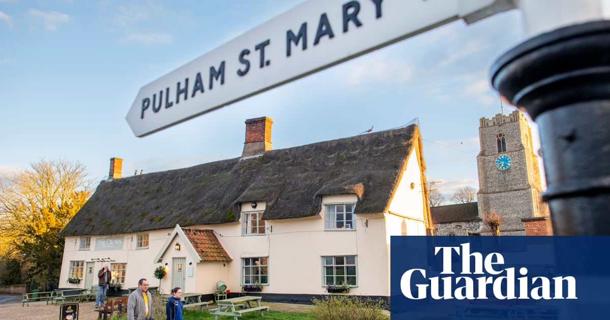
Today my boyfriend and I are here to walk an eight-mile stretch of the Boudicca Way, a 36-mile walking route connecting this market town with Norwich. Named after the warrior queen of the Iceni, it passes through verdant countryside in the iron-age Celtic Briton tribe’s territory, running roughly parallel to the old Pye Road (now the A140). We’ll end our afternoon hike at the impossibly pretty village of Pulham Market, where my mum still lives and where my father’s family were based for many decades.
My father was a keen walker, and introduced me to the route a few years back; as he died recently, the idea is to partly retrace those steps.
Leaving the station at Gilray Road we turn right up inauspicious-looking Vince’s Road (if you wish to explore the old town first, take the next left into Fisher Road). We pass through a modern housing estate to pick up the Boudicca Way at the corner of Frenze Hall Lane and Walcot Green, where the well-signposted rural track starts just beyond the railway bridge. In fact, for the duration of the walk we are impressed with the faultless signage; and for good measure, I’m also clutching a hand-drawn map my dad helped put together many years ago.
Under bright sun and blue skies, we follow the straight path up to the Frenze Beck, a tributary of the Waveney, and at a farm spy our first ancient monument, St Andrew’s church, built in the 13th century. Like many on this route, it’s now disused but kept open by the Churches Conservation Trust. Its sparse interior is tranquil, the sun streaming in on its many artefacts: particularly notable are the 15th-century carved monkeys on the arms of the prayer desk.
Then it’s back out along the river, with hoary oaks jutting out of its low banks. Dog walkers greet us at regular intervals, and we pass farms and sporadic Georgian houses as we meander down sun-dappled lanes.
The next church we encounter, in Thelveton, is also in the middle of farmland. Also called St Andrew’s, it’s not as satisfyingly minimalist inside as its namesake, but, now an hour in, we enjoy a brief rest on a mossy bench in its churchyard. We watch as a hare races past the gravestones.
Picking up the footpath again, I≈spy≈a herd of deer in a nearby field before we turn right up Broad Way, an≈appealing country lane with wide grass verges, before reaching an arable field from which we can glimpse the≈eye-catching round tower of the Grade I-listed St George’s church at Shimpling. We cross the wooden bridge over the stream and are pleased again to find it open, despite it also being disused. Its 12th-century tower, with octagonal upper stage and Victorian spire, excites my boyfriend, who has studied historical conservation and can wax lyrical on the differences between a nave and a chancel.
We follow the hedge-bound lane to Shimpling village, where a heritage map brims with stories about this settlement and neighbouring Burston, most notable for a remarkable incident in 1914: when the local school’s headteacher and his wife were unfairly sacked, the children went on strike to show support, even attending a “strike school”, which continued until 1939.
Pheasants flap into view as we cross a vast, featureless field towards Tivetshall St Mary. At the junction with Patten Lane, we follow the Boudicca Way sign up Primrose Hill towards the village. As we turn right into Ram Lane, two horses survey us from a field, while a muntjac lollops across the road, quite at ease. We’re three hours into the walk, and only now encounter our first pub: the Old Ram coaching inn, which dates from the 17th century. We eagerly order pints and flop on to comfy sofas in front of the fire.
But we’re still not at our goal. With the light lowering, we leave to cross the busy A140 and pick up the path for the final mile across farmland; at a cattle grid, we turn left up gently sloping Station Road (its former station, closed since 1953, is visible on the left). Pulham Market dates from the 12th century, its thatched cottages arranged around a green. With restored medieval painting and stained glass, the working 14th-century St Mary Magdalene church is grander and more extravagant than the others, its tower golden in the setting sun. Inside we’re surprised to learn that Norfolk has 659 medieval churches, one of the highest concentrations in the world.
Darkness is now falling, but happily the Crown is next door, glowing with invitation. Feeling a sudden sense of peace, I remember my dad’s favourite phrase: solvitur ambulando. Everything is solved by walking.
Google map of the route
Start Diss Station
Distance 8 miles (9.5 if walking into Diss town centre first)Time: 3-4 hours
Total ascent 71 metres
Difficulty Easy
GPX map of the route at Ordnance Survey
The Pub
The Crown is a 15th-century inn built to house the workmen constructing the church. A double-sided inglenook fireplace warms both the pub area and the adjoining dining room, with its low-beamed ceiling and artfully mismatched furniture. Over the years I’ve munched my way through the menu, from rosy ribeye to chicken supreme, but right now we crave a pint and some of its mammoth sausage rolls. After eight miles in three-degree cold, we’re delirious at such a simple pleasure. thecrowninnpulham.co.uk
Where to stay
On the other side of the green is the Old Bakery, a B&B with four spacious rooms, run since 2018 by Theresa and Jim Miller. A listed building, with wattle-and-daub walls and a timber frame, it was a bakery from 1580 until the last baker retired in 1951. The beamed rooms are furnished with antique furniture and comfy bedding and the en suite attic offers sunset views over the village green and church beyond. It’s available for bed-and-breakfast or self-catering.


