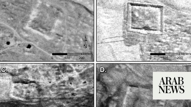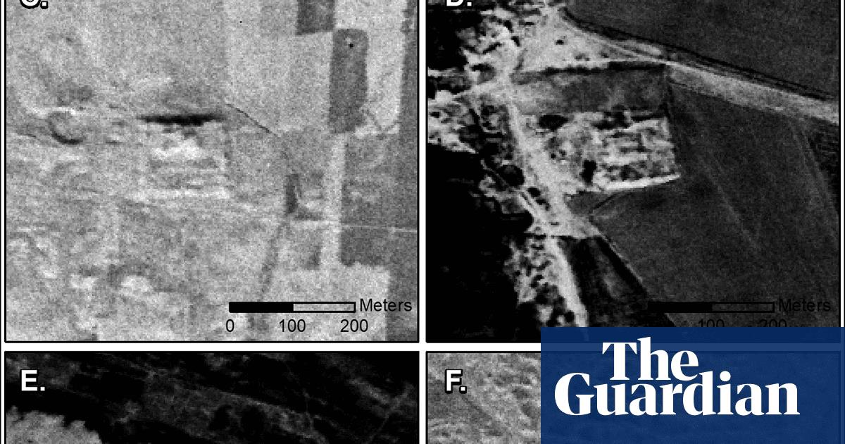
Declassified cold-war spy satellite images have thrown new light on the workings of the Roman empire by revealing hundreds of previously undiscovered forts, with dramatic implications for our understanding, experts have said.
Archaeologists examining aerial photographs taken in the 1960s and 70s said they reveal 396 sites of unknown Roman forts in Syria and Iraq across the Syrian steppe.
The findings, published today in Antiquity, an international archeology academic journal, have now forced a re-evaluation of life at the Roman frontier.
A previous survey of the region in 1934 by Antoine Poidebard, a French Jesuit explorer who pioneered aerial archeology in the Middle East from his bi-plane, recorded a line of 116 forts.
Until now, historians assumed these forts were part of a defensive line built to protect the eastern province of the empire from Arab and Persian incursions, and from nomadic marauding tribes intent on captive-taking and slave-raiding.
The new discoveries instead point to the frontier being more fluid and a vibrant place of cross-border trade, rather than of constant violent conflict, the authors said, with the forts supporting a system of caravan-based interregional trade, communication and military transport.
The authors said it now raises the question: “Was it a wall or a road?”
“Since the 1930s, historians and archeologists have debated the strategic or political purpose of this system of fortifications,” said the lead author of the research, Prof Jesse Casana, of Dartmouth college in New Hampshire, US. “But few scholars have questioned Poidebard’s basic observation that there was a line of forts defining the eastern Roman frontier.”
The 396 new sites, hidden by modern-day development, are widely distributed across the region from east to west, which does not support the argument that the forts constituted a north-south border wall.
Researchers now hypothesise that the forts were constructed to support cross-border trade, protecting caravans travelling between the eastern provinces and the non-Roman territories, as well as facilitating communications between east and west.
Significantly, this indicates that the borders of the Roman world were less rigidly defined and exclusionist than previously believed, said the authors.
The Romans were a military society, but they clearly valued trade and communication with regions not under their direct control, they added.
The images studied formed part of the world’s first spy-satellite programme conducted at the time of geopolitical tension between the US and Soviet Union and their allies, the western bloc and the eastern bloc.
They “preserve a high-resolution, stereo perspective on a landscape that has been severely impacted by modern-day land-use change,” said Casana.
He said it revealed the real value of satellite imagery for recording archeological features before they are lost.
“We were only able confidently to identify extant archeological remains of 38 of Poidebard’s 116 forts. In addition, many of the likely Roman forts we have documented in this study have already been destroyed by recent urban or agricultural development, and countless others are under extreme threat.”
As more imagery is declassified, such as U2 spy plane photographs, more new archeological discoveries will be able to be made. Casana said “careful analysis of these powerful data holds enormous potential for future discoveries in the near east and beyond”.


