Imeet up with Daniel Raven-Ellison, the brains behind the Slow Ways walking network, in the darkness of a drizzly dawn at Kidsgrove railway station in Staffordshire. Our mission? To walk and verify the final 17-mile (27km) link in the route between Birmingham and Manchester.
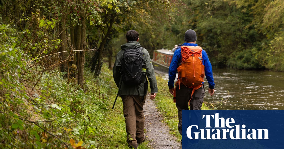
Steady drizzle falls as we head north beside another slow way – the Trent and Mersey canal. “You can walk from Godalming [Surrey] to Kendal [Cumbria] on canals,” says Raven-Ellison. “We’ve got this ready-made national trail and there’s no signage to invite you to do that … Kingfisher!”
He interrupts himself to point: above the stormy brown water dash two kingfishers, dazzling the day with their iridescent turquoise and ginger. This is, after all, part of the joy of walking. “Slow Ways is not just a walking network,” says Raven-Ellison. “It’s a network for all the things that walking gives us – making us healthier, happier, more productive, more creative and more relationship-rich. It is also lower carbon and better for the environment.”
Slow Ways is a community-created, peer-reviewed national network of pedestrian-friendly routes linking towns, cities and national parks. Raven-Ellison, a former teacher, national park cities founder and a person who seemingly generates a big idea every seven seconds, came up with the idea of using citizen mapping to create a national network of paths so people could walk between towns and cities one day when he began a walk from Winchester to Salisbury and his destination was not signposted on any paths.
“Apps reliably tell us how to get somewhere by car and train, and in cities they work for people on foot,” he says. “But why is it that no one has worked out the best way to go on foot between towns and cities and national parks? How do we have more than 140,000 miles of rights of way and nobody has tried to put it into a system that makes it easier to understand?”
The app, a social enterprise supported by the National Lottery’s community fund, was set up during the pandemic when frustrated locked-down walkers sat in kitchens and living rooms and drew up more than 9,000 walking routes across Britain. Since then, volunteers have put on their walking boots to verify the routes. So far, 60% of the network has been reviewed by at least one person but Slow Ways wants each route “peer reviewed” by at least three people to ensure they are safe, accessible and enjoyable. Each route is shared on the web and on its user-friendly free app, which also provides information on its accessibility to wheeled walking, from children’s buggies to offroad wheelchairs (Slow Ways is meticulous about ensuring routes are on accessible paths).
We pass beneath a bridge, which is actually an aqueduct bearing another canal, on to which we turn. Woodsmoke rises in a wobbly trail from the chimney of a narrowboat, the rain stops and the towpath walk becomes rather lovely. The Macclesfield canal has a rural feel with bullrushes beside the water, and pretty stone bridges curving over it.
The Slow Ways app guides us off the canal and down quiet sidestreets into the centre of Congleton in just over two hours. We’ve now verified Kidcon Two (6.2 miles) and so we set straight out on to ConMac Two (10.6 miles): each route name takes three letters from their starting and finishing destination. Now we are bound for Macclesfield.
“We’re literally creating culture by doing this walk,” says Raven-Ellison. “You’re walking for yourself but knowing your walk is also helping others – that’s really cool.”
Raven-Ellison is coy about how many miles of walk he has personally mapped because he does not want it to become a competition. But volunteers can create their own spider’s web-like maps of the routes they have verified, and route-verifying is addictive. One volunteer has walked from Brighton on the south coast to New Brighton on Merseyside. Another did a sponsored walk verifying Slow Ways routes between London and Gateshead.
More than 1,200 routes have already been fully verified linking Sheffield, Birmingham, Cardiff, Exeter and Brighton, but there are still 46,600 miles to go. Nevertheless, Raven-Ellison says the full network could be completed in a day if 20 volunteers in every town undertook one 6.2-mile walk (the average route length is 7.5 miles, a three-hour hike, but there are shorter 3.1-mile options and a few monster 25-mile ones too).
ConMac Two weaves us through a 1950s council estate in Congleton on quiet streets before we rejoin the Macclesfield canalside. Here we are overtaken – by a narrowboat.
Undeterred, we catch it up a mile later when it reaches a marvellous set of locks as the canal climbs into the rolling Cheshire hills. Walking is officially swifter than barge.
Past pubs, pastures, nature reserves, and plenty of canalside woodlands, the scenery is unexpectedly beautiful, the pace is relaxing, and there is no prospect of any delays. There is just one thing missing: other walkers.
Until we reach the outskirts of Macclesfield, we do not see a single person walking without a dog, and we pass barely a dozen dog-walkers during our six-hour walk.
To Raven-Ellison, our public paths are a vastly underused resource. With more volunteers, he hopes that Slow Ways can open them up to new users – providing safe, accessible, peer-reviewed pathways for walkers of all capabilities.
He is convinced that funding a national network of properly signposted paths, backed by more wheelchair-accessible paths and new rights of way will appeal to all political parties.
“The Victorians left us street trees and parks. National parks were the legacy of the second world war. What will our legacy be?” he says. “What if 75 years after the creation of national parks, our politicians created their own legacy for future generations – a proper national walking and wheeling network that’s as easy to understand as the road and rail network but far more joyful, healthy, green, relationship-building and community-connecting and inspiring? What’s not to like?”


