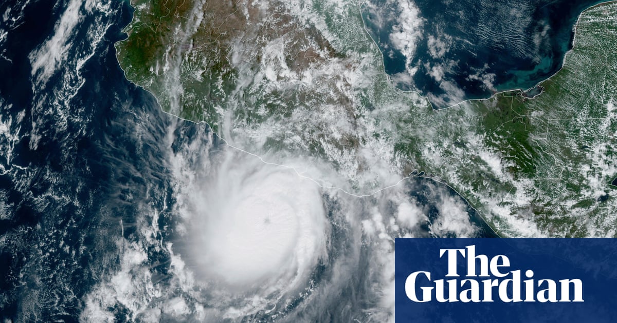
Hurricane Beryl, a powerful Category 3 storm, is expected to slam into the Caribbean on Monday, endangering several island communities with life-threatening storm surge, violent winds and flash flooding.
The hurricane’s core is most at risk of striking Grenada, St. Vincent or the Grenadines beginning early Monday morning. Beryl is expected to remain a major hurricane as it barrels through the Windward Islands on Monday and continues moving through the Caribbean early this week.
Beryl’s arrival marks an exceptionally early – and likely devastating – start to the Atlantic hurricane season. It reached Category 4 strength on Sunday, making it the earliest storm of such strength on record in the Atlantic Ocean and the only Category 4 storm ever recorded in the month of June. By early Monday, the storm had reduced slightly to a Category 3.
If Beryl regains some of its strength, it is poised to be the strongest storm the area has seen since Hurricane Ivan in 2004.
Islanders were scrambling to finish final emergency preparations Sunday night even as tropical storm-force winds approached. Local officials are warning of potentially catastrophic impacts, including damage to homes, widespread power outages and threats to residents’ safety.
“I want everybody in Saint Vincent and the Grenadines to take this matter very seriously,” Prime Minister Ralph Gonsalves said. “There are some persons who are hoping for the best, and we must all do that, but we all have to prepare for the worst.”
Here’s the latest:
• Beryl unleashes 130 mph winds: Beryl was unleashing 120 mph winds and sat about 110 miles southeast of Barbados as of early Monday, according to the National Hurricane Center. Hurricane-force winds extend outward up to 30 miles from the center and tropical-storm-force winds extend outward up to 115 miles.
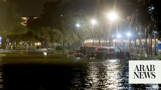
• Life-threatening storm surge and flooding: The National Hurrican Center warned that “life-threatening storm surge will raise water levels by as much as 6 to 9 feet above normal tide levels” near where Beryl makes landfall. Towering waves could also create life-threatening surf and rip currents and threaten small vessels and fishermen. Flash flooding is also a concern in parts of the Windward Islands and Barbados, where rainfall of 3 to 6 inches is expected through Monday. Barbados Prime Minister Mia Amor Mottley warned citizens to be “extremely vigilant.”
• Hurricane warnings across the Windward Islands: Hurricane warnings are in effect for Barbados, St. Lucia, Grenada, Tobago, St. Vincent and the Grenadines. Tobago’s meteorological service also issued a red-level warning for the island – their most severe weather alert – and residents are urged to take action to protect their lives and property, including securing food and medicine or evacuating if their homes are vulnerable.
• Hundreds evacuated to shelters: More than 400 people were being housed in hurricane shelters across Barbados Sunday night, the nation’s Chief Shelter Warden, Ramona Archer-Bradshaw, told CNN affiliate CBC News. “I am pleased that people are using the shelters, if they are not comfortable at their homes, it is best to go to a shelter,” she said.
• State of emergency in Grenada: A state of emergency was declared by Grenadian Governor General Cecile La Grenade which will remain in effect from Sunday night to Tuesday morning. All businesses will must close except the police force, hospitals, prisons, waste disposal and ports.
• Airports closed: Airports in Barbados, Grenada and Saint Lucia were closed Sunday night as Beryl approached. Grenada’s Maurice Bishop International Airport is expected to reopen Tuesday morning, a spokesperson said. The Grantley Adams International Airport in Barbados and St. Lucia’s Hewanorra International and George Charles airports have also halted operations.
• Widespread tropical storm advisories: Tropical storm warnings are in effect for Martinique and Trinidad, the National Hurricane Center said. Less severe tropical storm watches are also in place in parts of the Dominican Republic and the southern coast of Haiti.
• Cricket World Cup fans stuck: Barbados is still hosting cricket fans from around the globe who traveled to the island for the T20 World Cup, some of whom will not be able to evacuate before Beryl arrives. “Our visitors are here with us,” said Barbados Prime Minister Mia Amor Mottley. “Some of them are not due to leave until Monday and Tuesday, and some of them have never gone through a hurricane or a storm before.” She implored residents to provide support for visitors, if possible.
Beryl is ushering in an unusually early start to a hurricane season that forecasters have warned will be hyperactive – and Beryl’s record-shattering activity may be a sign of what’s to come.
This season is already off to a busy start as a second storm – Tropical Storm Chris – is churning in the Gulf of Mexico and is expected to hit Mexico’s eastern coast early Monday.
Beryl is the earliest major hurricane – defined as one that is Category 3 or higher – in the Atlantic in 58 years. The storm’s rapid intensification is very atypical this early into hurricane season, according to National Hurricane Center Director Mike Brennan. It’s rare for tropical systems to form in the central Atlantic east of the Lesser Antilles in June, particularly strong ones, as only a handful of tropical systems have done so, according to NOAA records.
The storm isn’t just early for this season. It is now the Atlantic Ocean’s third-earliest major hurricane. The earliest was Hurricane Alma on June 8, 1966, followed by Hurricane Audrey, which reached major hurricane status on June 27, 1957.
Beryl has also set the record for the easternmost hurricane to form in the Tropical Atlantic in June, beating a previous record set in 1933.
The central and eastern Atlantic traditionally become more active in August, in part because ocean temperatures have had time to warm and fuel developing systems.
This year, however, the Atlantic basin has seen above normal water temperatures and a lack of wind shear due to the transition from El Niño season to La Niña season, both of which are fuel for tropical development.
“Beryl has found an environment with very warm ocean waters for this time of year,” Brennan said.
Systems forming this early in the summer in this part of the Atlantic is a sign of the hyperactive hurricane season to come, according to research from Phil Klotzbach, a hurricane expert and research scientist at Colorado State University. Normally, ocean temperatures aren’t warm enough in June and July to help tropical systems thrive.
National Weather Service forecasters predict 17 to 25 named storms this season, with as many as 13 of those becoming hurricanes.
“That’s well above average,” Brennan noted. — CNN


