شركة رقمي
نقل من موقع 

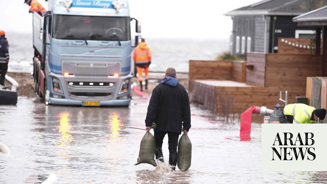
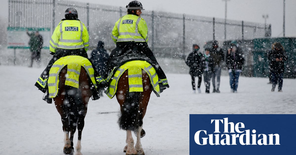
Snowy blizzards, heavy rain and gale-force winds are expected to batter large parts of the country on Sunday, setting up for a week of wintry conditions ahead as a weather front dubbed the Beast from the East 2 sweeps in from Scandinavia and Russia. Southern and eastern parts of England will generally see the worst of the weather, but there are yellow warnings for snow and ice across the length of Britain this weekend, which will remain in place until Wednesday. A more serious amber warning is in place for Norfolk, Suffolk, Essex and Kent. The Met Office said strong easterly winds – in some cases, reaching over 40mph – may lead to “blizzard conditions” and blowing and drifting of lying snow at times. This Beast from the East – a phrase used to describe wintry conditions in the UK caused by easterly winds from the near continent – is a result of cold air from Scandinavia and Russia combined with a weather front named Storm Darcy by the Dutch meteorological office. The best remembered Beast from the East hit Britain at the end of February 2018, bringing with it 10 days of heavy snow. This time round, daytime temperatures will remain in the low single figures in most parts of the country and some places will stay below freezing, with a considerable wind chill and widespread frosts making the air feel even more glacial. Parts of the UK may feel as cold as -5C on Sunday. The Met Office chief meteorologist, Paul Gundersen, said: “The UK is in for a notably cold and snowy period over the next week, with very cold air in place over the whole of the UK.” Significant and widespread snow is going to accumulate in Scotland and parts of eastern England, he warned. In parts of east Norfolk, east Suffolk, Kent and around the Thames estuary Gundersen said “we could see 5cm to 10cm of snow quite widely, with a chance that a few places could see 20cm or more”. Even central London can expect a few centimetres of snow, the Met Office says. Rain is expected to move westwards over the UK on Sunday, although it will increasingly turn to snow. Motoring services group the RAC is bracing itself for a sharp increase in breakdowns and “bumps” because of the “very hazardous” conditions on Britain’s roads, and is advising people to think “extremely carefully” before setting out on journeys. There are warnings some roads may become blocked, with the possibility of vehicles and passengers being stranded. RAC spokesman Ben Aldous stressed that drivers who do go out need to make sure their vehicle is ready for the unusually cold weather: “This means checking oil, coolant and screenwash levels, as well ensuring the tyres have plenty of tread and are inflated properly,” he said. “Large amounts of snow on vehicles should be cleared before setting off to avoid it falling on to other road users.” The weather in the Midlands, Wales, south-west England, northern Ireland and western Scotland will be largely dry and bright, with sunny spells. However, even in these places, it will feel bitterly cold. By tomorrow, the average daytime temperature will range between only 1C (34F) and 4C across the country. Public Health England warned that such severe cold weather can increase the risks of heart attacks, strokes and chest infections among older people and those with heart and lung problems. It urged people to check on frail and elderly neighbours and relatives. “Make a call, or socially distanced doorstep visit if they live close by, to remind them of some simple but important health tips such as heating their home to at least 18C and to keep up to date with the forecast,” said spokesman Dr Owen Landeg. “It’s also helpful to check they have enough food and drinks and any medicines they need.”
مشاركة :