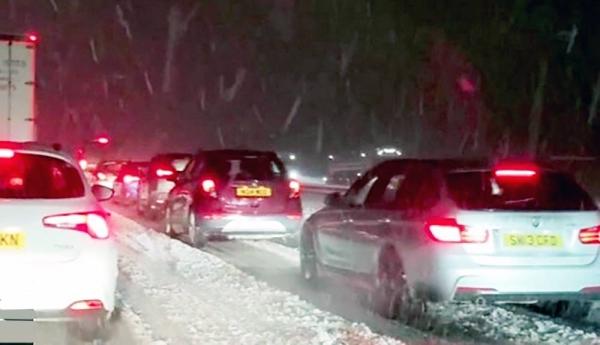
Parts of eastern England and Scotland woke up to flurries of snow on Thursday morning, with more snow, hail and ice expected in a dramatic contrast to last week’s spring-like weather.
Top temperatures across the UK are forecast to plummet from last week’s highs of 20C to reach a maximum of 10C this weekend as a result of air coming from the Arctic bringing temperatures below average for the second week of spring.
West Yorkshire woke up to a deep blanket of snow after several hours of snowfall during the night, although Manchester and Durham also saw significant drifts, and some light flurries were seen further south-east in the east Midlands and East Anglia.
Temperatures fell below freezing between Wednesday night and Thursday morning, with some councils, such as Newcastle City, issuing emergency protocols to deal with the sudden change, including services to help people sleeping rough.
A Met Office yellow weather warning for ice, covering a swathe of eastern Scotland, north-east England and Yorkshire until 10am on Thursday, stated that “snow and hail showers could lead to icy surfaces, with possible travel disruption”, with snowfall potentially affecting roads at high elevations.
A Met Office spokesperson, Nicola Maxey, said any of the band of showers pushing through the east of England and Scotland on Thursday could turn into snow, with the potential for 1-2cm of lying snow in parts. “Any snow that accumulates won’t last very long at this time of year because the ground is quite warm,” she said.
Widespread frost is forecast for Thursday evening, and the Met Office has put in place a yellow warning for a risk of disruption from ice and perhaps snow on Friday morning across parts of Kent, Sussex, Suffolk, Essex and East Anglia.
Matty Box, a meteorologist, said there was currently a “cold air mass” over the UK. He said there would be a similar chance of concentrated snow, rain and sleet showers in eastern and northern areas of the UK over Thursday night and Friday morning as well.
The weather is expected to gradually improve over the weekend, with “a fair amount of sunshine” and some sunny spells, Box said. “Showers will become less frequent, but still with the chance of some wintry showers in the east coast and the North Sea coast, in particular through Saturday.”
Maxey said the contrast in weather over the past week was not unusual for spring and was caused by pressure shifting and allowing cold Arctic air to push south across the UK. Since there is moisture in the air, this may fall as snow.
“Spring is a transition period from winter into summer so you get swings in temperature and weather type, you can quite easily go from warm sunny spells to colder incursions with a bit of snow and frost,” she said.


